Stumbling into The Badlands


We wandered southeast from Durango, Colorado and crossed into New Mexico as it started to get dark. After Aztec and Bloomfield we started to get hungry. The map indicated about 80 miles across empty high desert to Cuba, without an indication of a developed campground. Then, seemingly out of nowhere there was a little brown sign for Angel Peak Scenic Area, it even had the tent symbol for camping. We turned off onto a dirt road. hard-packed and heavily rutted.

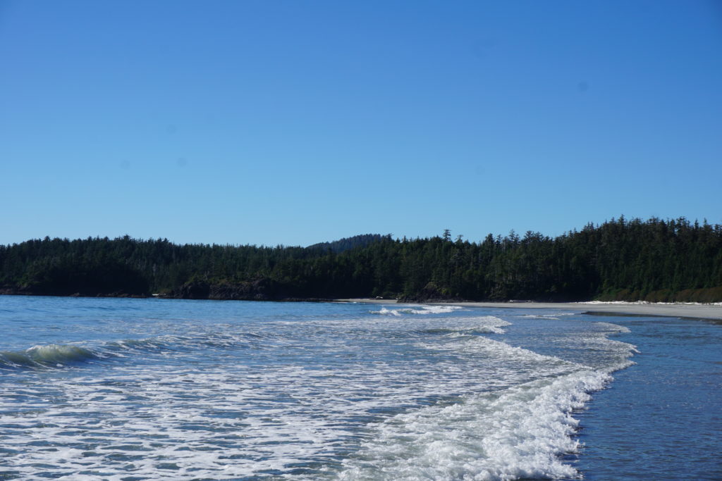
It was dark and windy, scrub brush showing intermittently in our headlights on the ochre sand of the high desert. After a couple miles we came to a little dirt pull out marked Badlands Overlook but we saw one pickup with a camper there and so we kept going. All the rest of that night we did not see sign of another vehicle.It was dark as could be but it seemed there was a little rise to our left as we crawled along. We saw another sign indicating the campground somewhere up ahead but after 5-6 miles and passing a couple other picnic areas we decided that the Castlerock Overlook would suit us just fine. There was a little picnic table and a shelter built over that, it was nicely done. We shut off the engine and set up camp.

In a VW “Westy” camper setting up camp, means raising the pop top if you want some head room and pulling the curtains shut if you want some privacy. Also, since we were hungry we had to pull out the frying pan and set it on the stove top. It was too windy outside to worry about a fire so I didn’t try to find any firewood but I did pop another kind of top, the one on my beer, and stepped outside to see what I could see. First thing I “saw” was a noise, a sizable diesel engine not far away droning away at its labor. I thought this might be related to all the oil and gas development infrastructure we’d seen driving in, but wasn’t sure. I walked a few feet away from our bus and I could see there was a definite drop off, lights were twinkling in the distance and far below. It seemed we were on the edge of a bluff looking down on the San Juan Basin. The clouds were dark and low, no stars and no moon. It wasn’t very cold but there was a lonesome feel on the breeze..

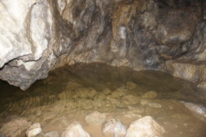
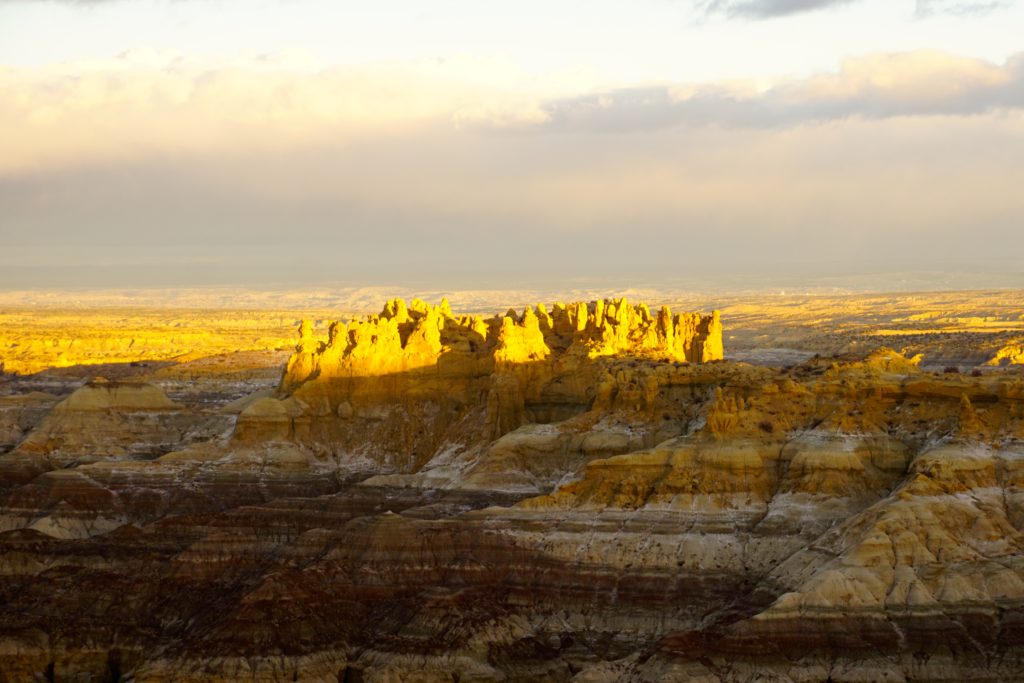
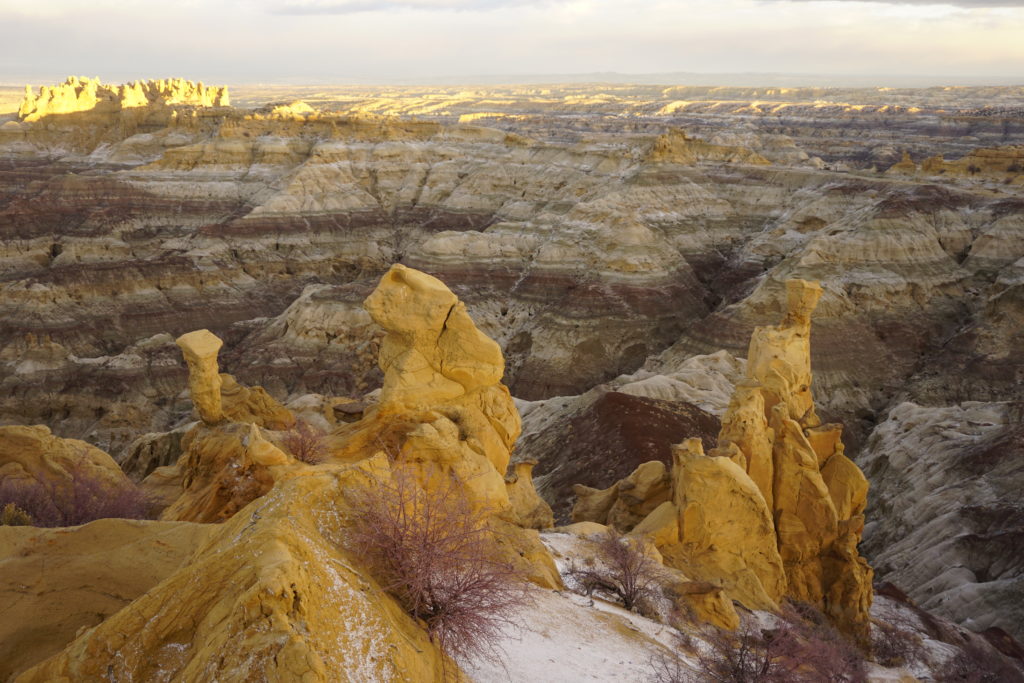
The rain came heavy and sudden a little after midnight preceded by thunder and lightning as a cold front moved through. After a little while it got quiet again and I drifted back to sleep. Early in the morning I awoke and thought not for the first time that I should upgrade to a warmer sleeping bag one of these days. I got dressed and stepped outside onto the crunch of a dusting of fresh coarse snow. The wind was biting but I walked into it towards the drop off and saw a Badlands landscape. The sun was not quite up but I could tell there were many bands of different colored rock stacked up in other worldly towers and pyramids and indescribable shapes. The sight and the wind was almost enough to take my breath away but when I turned back to the van I glanced up towards the light in the east and saw something I’d never seen before. There, circling high above in a tight gyre, were two enormous birds. I had recently spent several months in Alaska and British Columbia and know what eagles are. These were much bigger. I wondered if they were condors but I had never heard there were condors in New Mexico.

dsc04822


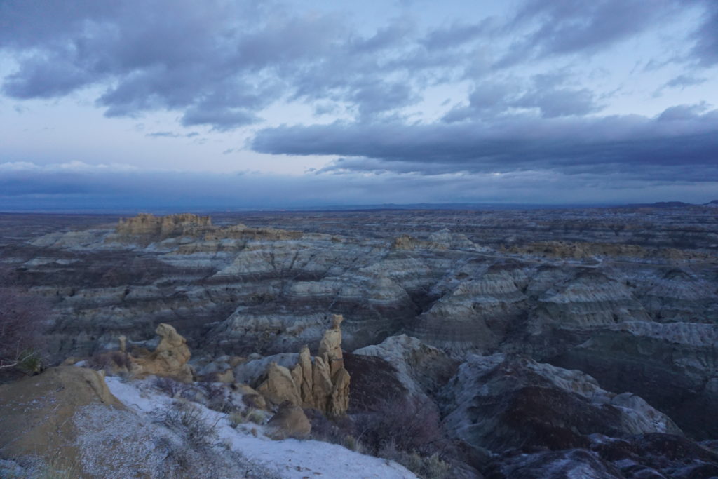
By the time I had retrieved my camera from the van they were gone, and I wondered, had I really seen them? However, the sun was starting to light up the rock formations and I wanted to get some pictures so I put the condor conundrum out of mind. I did keep looking over my shoulder, however, I didn’t see them again. Some time later though, my wife Karen came to find me and when she did she excitedly told me about this enormous bird she’d seen, far bigger than an eagle she said. I didn’t say anything but pointed out to her the glowing vertical spires now alit by the rising sun and contrasted against the shadowy gray and lavender layers below. At that moment all questions of what was real fell away leaving the experience of the moment. We had stumbled into the magic of the Badlands.

dsc04833 dsc04838

Without realizing it we had also wandered into the San Juan Basin, one of the most productive natural gas areas in the country. Here right in the midst of unreal beauty the machinery of extraction was ceaselessly pumping and lifting the precious gas up from subterranean rock to the surface for processing and transportation to all us energy hungry Americans. Extending from Durango, CO in the north and down almost as far as Albuquerque, the San Juan Basin encompasses some 4600 square miles. It contains the 2nd largest proven gas reserves in the U.S. and produced some 750 billion cubic feet of natural gas in 2013. In 2001 the region produced about 30% of the nation’s consumption but this dropped to about 4% in 2015 due to cheaper gas extraction from the Marcellus region.

The San Juan Basin is also the location of a huge hot spot of methane pollution discovered in 2014 by NASA researchers. Methane makes up about 95% of natural gas and is colorless and odorless (the stinky odorant, mercaptan, is added later in the production process) and it dissipates rapidly into the atmosphere making detection with human senses difficult. Methane is about 80 times more potent than CO2 in short-term global warming. This was this an incredibly important scientific finding.

methaneleak-sjb
Note the hot spot over NW New Mexico

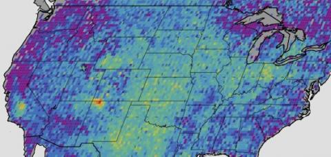
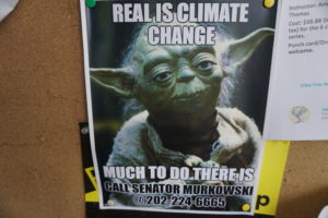
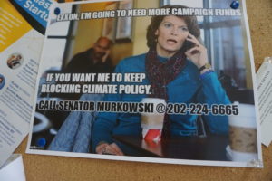
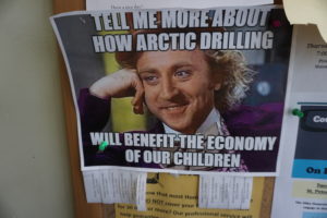
According to a 2016 study published by the Center for American Progress, oil and gas producers leaked the CO2 equivalent of 14 coal-fired power plants over a year period. NASA researchers zoomed in to analyze where exactly the leaks were coming from and analysis of this data suggests only 11 companies account for half the problem. Wells in the San Juan Basin have the highest amount of emissions per well.(https://www.americanprogress.org/issues/green/reports/2016/06/20/139709/the-whos-who-of-methane-pollution-in-the-onshore-oil-and-gas-production-sector/) It should be noted this type of science is exactly the thing that Republicans in congress are working to quell. The image of extinction-threatened ostriches with their heads buried in the high desert sand comes to mind.

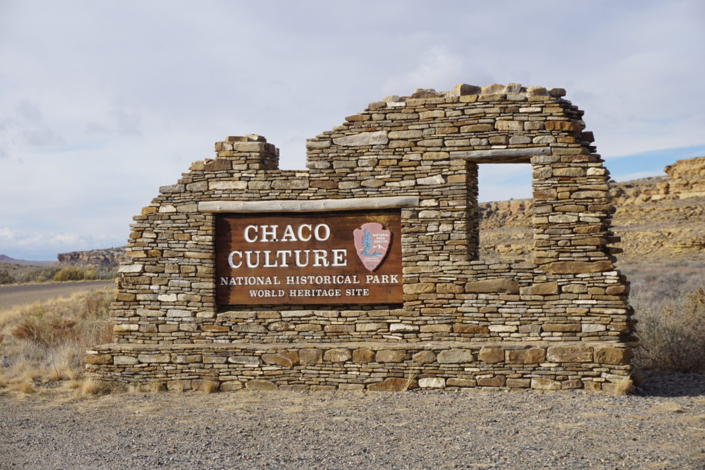
Heading south from the AngelPeak badlands you come very shortly to Chaco Canyon Culture National Historical Park. We’d never been here, hadn’t even heard of it so of course we wandered out that way. After enduring some of the worst washboarded roads I’ve been on we finally made it. There, carefully uncovered by archeologists are the ruins left from a people that thrived here for more than 400 years, from about 800-1200 A.D. It is thought that they died off or dispersed due to extended drought conditions. Although the people were gone the lesson left in that sandy, dry lonesome place remains for all to see if you take the time.

dsc04856 dsc04865

dsc04870

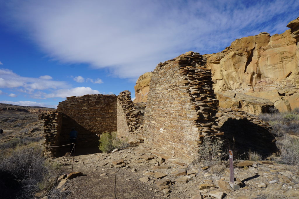
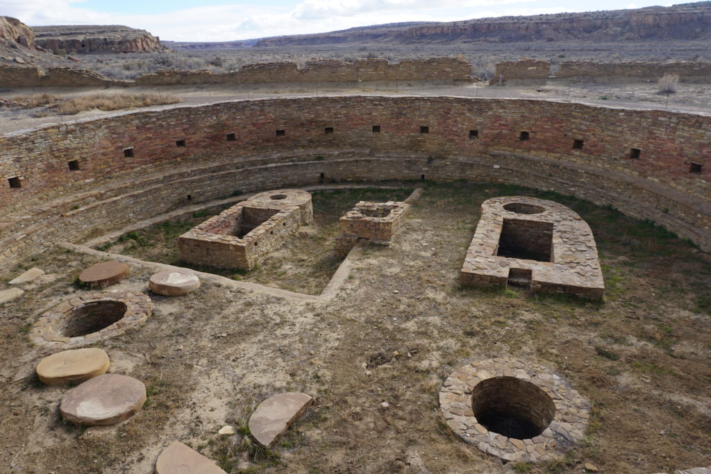
While just a few miles up the road modern humans experiment with hydraulic fracturing and technology to extract every last drop of oil and gas, here at Chaco Canyon a great civilization exceeded the capacity of its environment to sustain it. Climate deniers in congress are working to shut down the science that warns us of impending mega drought conditions across the southwest, and to remove cumbersome regulations hindering fossil fuel developers. Meanwhile in dusty, windy, abandoned places like Chaco we can hear the echoes of our ancestors whispering a warning.

The End of Summer

“Nobody on the road, nobody on the beach. I feel it in the air, the summer’s out of reach.”  (The Eagles/Don Henley). And so, we left the sunny beach at Rugged Point to the wolves and the bears and went back out into the ocean and down to Espereranza Inlet.

dsc04205
Rugged Point Parc Marin


Riding the west swell into Gillam Channel and taking the inside route brought us after a couple days to historic Nootka Sound where for millennia the Nuu Chah Nulth have abided at Yuquot. Here we contemplated the intersection of aboriginal and european cultures. In 1790 the English and Spanish signed an accord here that prevented a war between the two colonial powers as they vied for control of this part of the New World. Only two centuries later the presence of the white man seems greatly diminished but the Muchalat Band remains. It was to the Band’s elder Ray Williams that we paid our landing fee and got permission to walk around and explore.

dsc04280
Nootka Light Station

dsc04281

dsc04283

Above: Inside of the Catholic church donated by the Spanish, now more of a First Nations cultural house. Set aside on the floor are a few very graphic christian images, romans hammering spikes through Christ, etc. No doubt these were helpful in showing the heathens how civilized people treat each other. We paid Ray a few bucks extra to stay on the dock overnight but it was a noisy, unsettled arrangement. It was a weird dock and it woke me up squawking and groaning, I had to go out to adjust lines in the middle of the night. Unresolved tensions, maybe?
Anyway, we departed Nootka at first light and rounded Estevan Point, the 3rd most exposed rounding on the West Coast. It was a little bit rough and a little bit chilly and a slow passage but as we pulled into Hot Springs Cove the sun came back out. The Hot Springs is a major tourist destination with many boats and float planes bringing folks over from Tofino to experience the miracle of geothermal bathing. We broke out an early happy hour and waited until almost everyone had left before we rowed ashore and hiked out the boardwalk to take a soak. It was marvelous! Showers as strong as a therapy jacuzzi and as hot as you could stand it. Very relaxing.

dsc04315

dsc04311

Next day we cruised down to Tofino and checked out the surfing town that sucks on the teat of tourism. Very cool place but it did not have the off-season feel that we’d hoped to find. Many no-vacancy signs hung outside the motels all along the strip. By one day we had missed the dedication of a sculpture that had been acquired and brought back to its home in Tofino. She was cast in the 1980’s as the anti-logging protests were building. The message of Weeping Cedar Woman is “Stop, and consider Nature.” More and more I discover truth in fiction and in art. Don’t you?

dsc04330
Weeping Cedar Woman

Back out on the ocean we went slowly down into the fog at Amphitrite Point and up to the little town of Ucluelet, known affectionately by locals as “Ukee”. Although it also is reliant on tourism it did feel off season and had an entirely different vibe from Tofino, more family-like, more blue collar. We liked it.

dsc04340
Raven Lady (Surf woman in background)


dsc04341
1850’s anchor found in 1996 by a fishing vessel in 540 meters

From Ukee we expedited out visit in Barkley Sound in deference to our desire to keep moving on. It is a lovely place, much loved by cruising sailors. I especially like the rugged islands in the eastern part that have sea caves and lots of snug beaches to explore.

dsc04351
Tarani, our stout and faithful vessel at anchor, Tzartus I.

At the southwest corner of Barkley Sound sits pretty little Bamfield. There’s not much here, the town’s divided by a 2 mile inlet, half the town doesn’t have roads, only sidewalks. There’s a pub with no beers on tap, a mud and gravel road up to the Marine Sciences Center, a Health Center, a few restaurants, a couple stores and, well actually it is a pretty cool town. I could spend more time here someday. Met an inspirational figure here, a fellow sailor and retired firefighter from Vancouver (big Vancouver, that is) who retired 27 years ago and still looks fit as a fiddle, full of life. This got me thinking.

dsc04392
Bamfield

Its been four months since Karen and I left Port Townsend to explore and experience the maritime environment of the Pacific Northwest. We’ve seen much and have loved it, but as Debbie Downer (not Karen) says, “all good things must come to an end.” Tonight we sit at anchor in Bamfield, tomorrow we start the long run down the Strait of Juan de Fuca and back towards civilization. But, in less than a week we will be back to Port Townsend and back to “normal”, or will we?

dsc04393
Pre-dawn departure Cape Beale, last day of summer 2016

I think our experiences have changed us. Maybe the effect will fade after a few months but I now know more about the natural world than when I started. We’ve seen humpbacks and orcas, porpoises and otters,  ravens and eagles, grizzlies and black bear. We’ve become intimate with the tidal cycle, wandered wilderness beaches and rediscovered ourselves. And we have met a lot of good people. I have greater hope for the future even when humans seem oblivious to our interdependence with all life.

I am more sure than ever that I will be involved in the seemingly hopeless struggle to help humanity confront the reality of climate change, but I need to maintain my sanity and immerse myself in nature on a regular basis. I will continue to encourage people to transition away from burning fossil fuels for energy, and to demand from our government protection of the environmental Commons. The sooner we can mitigate the damage we are doing, the better the chances for human survival and the less damage we do to the other species sharing our ecosystem. I especially want to get involved in societal efforts to prepare for and adapt to the changes expected. These run the gamut; extreme weather, droughts and famine, sea level changes, ocean acidification, increased global conflict, mass extinctions and the potential for the collapse of human civilization. I feel privileged, challenged, humbled and horrified that I am alive during this period of human history. We have burned the fossilized remains of life from eons past and we have opened Pandora’s Box. Yes, it seems likely that our ship will be thrown up on the rocks but as mariners know you have to stay with your ship, she’s the best chance we have and we may yet survive the coming winter’s storms. So, hang on matey! Even though it looks like the end of summer for globalized human civilization we can hope for the dawn of something better.

dsc04396
Strait of Juan de Fuca sunset on the last day of summer, 2016.


South of Brooks Peninsula

We paid the monthly charge of $119 to stay at the Coal Harbour marina run by the Quatsino First Nations folks. Nice place. Quiet, clean washrooms and showers, laundry, and reliable bus service into Port Hardy. $119, including power. When you think about that, its a hell of a good deal. We parked the boat here for 10 days so I could make a trip back east to visit family and attend a funeral. Karen worked hard while I was gone on minor maintenance.On returning to the west coast it was sunny September weather but I detected a whiff of autumn and began to faintly hear that old Zeppelin tune, feels like its time to Ramble On.

DSC04091
quiet Coal Harbour

The night before we planned to go south around Brooks peninsula found us pre-rigging the sail with a double reef. The forecast included northwest winds of up to 20-30 knots. I expected and hoped we would be able to shake out one or both reefs after we got on our course but Cape Cook on the Brooks peninsula along with Solander Island standing just off the coast deserve respect. We would be trying to stay about 5 miles offshore and we wanted to be ready. Once our work was done the sun was setting gloriously. We relaxed with a cold beer and cooked up a nice little piece of ling cod that a fisherman had given us in exchange for a spare lightbulb we’d given him. It felt great to be at anchor in a quiet cove away from megalopolis.

Retired nurse showing how to use a foley bag.

Next day dawned dark, that is we left before dawn. Sun was rising as we went out from Quatsino Sound. about an hour later. Swells were of decent size on this trip, 2-3 meters. Wind turned out to be just about perfect for us, about 15-20 knots going our way. After 4 hours or so, we were abeam Solander Island we altered course and went into the Bunsby Isands.

dsc04130
Downwind around Brooks Peninsula

The Bunsbys are the site where sea otters were reintroduced to the environment back in 1969. They had been nearly hunted to extinction over a short period in the late 1700’s to the early 1800’s., basically eradicated from California to Alaska. It was typical short-sighted human behavior, a lust for their pelt and greed for money. Between 1969 and 1972 some 89 sea otters were released here and by 2008 their population had grown to an estimated 5,000. Another survey underway now is expected to show much greater numbers. In Alaska some 450 animals were reintroduced and by 2012 the population had grown to an estimated 25,000. Our anecdotal experience just over the past few years is that sea otters are more ubiquitous. We have noticed a curious difference between Alaskan animals and those of Vancouver Island;. Although all the otters in Alaska, B.C. and Washington are of the Northern species the Alaskan otters seem to be much shier around people. The Vancouver Island animals don’t dive until our boat is much closer. To be clear we don’t try to approach them but they are often floating nearby as we follow our course. At anchor on the west coast you will sometimes here a “clack-clack-clack” next to your boat and find another busy cracking his clam against a rock on his belly.

Crew from s/v Arrow at Walters Cove, only critters we've found cuter than sea otters.
Crew from s/v Arrow, only critters we’ve found cuter than sea otters.

The recovery of the sea otters is not without controversy. They exist in ecological balance with sea urchins and kelp. They eat crabs and shellfish and so find themselves in competition with humans. The Nuu Chah Nulth and other coastal First Nations groups are however supportive of the effort and would like to regain the balance within which their peoples thrived for millennia prior to contact with “civilized” white man. There is concern that some fisherman may already be taking matters into their own hands, killing animals. It seems mankind has not yet learned to live in balance with the ecosystem. We seem to be especially hard-headed and ignorant. We have such a hard time learning that we are inseparable from nature. We forget the lessons of history at our own peril. For further info in sea otters here’s a general reference and an article on the recovery:

http://www.defenders.org/sea-otter/basic-facts
http://www.theglobeandmail.com/news/british-columbia/the-remarkable-comeback-of-sea-otters-to-the-bc-coast/article19681665/

dsc04201
Rugged Point Marine Park

dsc04250

Sea Otter Cove

Left Port Hardy and made it down to Bull Harbour, docked at the guano rich dock of the Tlatlasikwala Band dock. After getting permission from a rep for the Band (and a warning about wolves) we walked down the road and across the trail to Roller Bay beach, fully exposed to the Pacific Ocean.

DSC03972

DSC03952 DSC03955

Found some wolf tracks. Picked up some plastic trash.

Next day went down under Tatnall Reefs (instead of crossing powerful Nawitti Bar 2 hours prior to slack) and worked our way past Cape Sutil and past the infamous Cape Scott waters and then turned south down the west coast of Vancouver Island.

DSC03997

DSC04000
Cape Scott, the extreme NW point of Vancouver Island and the confluence (often) of differing currents and winds

Weather rounding Cape Scott was fine but we had some residual swell that made our little boat roll quite a bit and it was uncomfortable for a couple hours. No big deal, nobody lost their lunch. We went into Sea Otter Cove. Tied up to one of the mooring buoys that are said to be rated to hold the big fishing vessels. We ended up spending 3 nights there , riding out a 24 hour gale and another day of strong SE wind. Winds SE 35-45 with gusts to 55.


DSC04037
1 of 3 hardy Vancouver Island surfers

2nd day there we inflated the dinghy and I rowed ashore to look for the fender that had blown away in the gale. Plus I wanted to hike over to Laurie Bay and check out the exposed beach there after the storm. Also, we had met 3 dudes and a black lab puppy in a Lund skiff headed over there and I wanted to see what they might be doing wearing wet suits and hiking with surf boards on their shoulders. I caught up with them on the beach. They were disappointed with the wave action but I was amazed at their hardiness. They stopped by our boat on their way back out in the afternoon and had a beer while they wondered whether their skiff would be able to get back out around the point into San Josef Bay against the rising wind. We invited them to come back for dinner if they couldn’t get around but I knew they’d make it  fine.

DSC04044


DSC04053
The enchanted fish float bog trail from Sea Otter Cove to Laurie Bay


DSC04058

Sailing in from offshore to Quatsino Sound and to Winter Harbour.

DSC04091

Next day went up through Quatsino Narrows into Coal Harbour where we will moor the boat for a week while I fly back east for a family visit. The Quatsino First Nations bands run a nice quiet moorage here. Good people, good place.


Leaving Port Hardy

After hearing the sad news yesterday of the passing of  my Uncle, C.F. Seabrook II, I am more eager than ever to head south and towards home. I miss my family. Leaving Port Hardy B.C. today. Weather forecast looks decent for rounding Cape Scott tomorrow morning before the southerlies fill in along the west coast of  Vancouver Island. The sunrise this morning is amazing and inspiring so I dedicate it to the memory of Uncle Charlie.

DSC03937

Now, what’s that old saying? Something about red sky in morning?

Blame it on the Moon

Why does a man try difficult things when he doesn’t have to? Why do people push themselves physically to perform at a higher level or mentally to learn more than is required? Call me stupid, I retired early from a well-paying career, not because it ill make my life easier. I want to try things that my aging body won’t be capable of in twenty or maybe only ten years. I want to learn more about the world I live in. I want to learn about trees and fish and birds and bears. I want to learn how to operate a high frequency radio and to use a sextant to navigate by the sun and the stars. And the Moon. I want to learn and better understand, the tides. How do they work? What influence do they have on us? Are the tides the earth’s respirations? What are all these amazing creatures living in the inter-tidal zone?


DSC03844

Karen and I have lived with the tides over the past several months. The tide tables are consulted daily and influence when and where we go. Recently we’ve learned more about how easy it is to underestimate tidal currents. A few nights ago we took a “shortcut” around Anger Island where Petrel and Principe channels meet and we went up into Ala Passage. We carefully worked our way in through a labyrinth of tiny islets and reefs and anchored near the inlet to Wright Lagoon.

Tarani at anchor, Ala Passage.

A tidal lagoon is a body of water that takes water in at high tide and spills it back out as the tide drops. The outlet to Wright Lagoon forms up to a seven foot tidal fall at low tides. It is a beautiful spot, as secluded and cozy as any anchorage you could imagine. We slept peacefully that night and the next morning launched the dinghy a little after low tide to explore. Sea stars, urchins, anemones, balls of krill shrimp, jelly fishes.

DSC03776

We quietly rowed and drifted towards the inlet of the lagoon. It wasn’t until too late that I realized the water was flowing faster than I’d thought. I started rowing against the flood as it pulled me towards the lagoon, faster and faster. It didn’t appear dangerous but we didn’t want to be stuck in the lagoon waiting for high tide. I started rowing harder, the oars of uneven length not pulling the under-inflated dinghy very well.

DSC03847

Karen was yelling, “faster, faster” but I soon realized I wasn’t strong enough to row our slug of a dinghy against the flood and instead worked towards moving sideways into the lee of a large rock. Finally made it there and while I caught my breath we tried to come up with a plan. We thought that one of us could probably make it to shore, climb up the barnacle slopes and, with the dinghy’s painter pull it upstream while the other person used the boat hook we’d brought along to push the dinghy away from the rocks out into the stream.

DSC03769

So this is what we did but we had to kind of leapfrog our way upstream. We pulled against the stream and worked against time. The flood was increasing in strength and the water level was rising. After we’d made it above what had now become a full-on boiling rapids I thought it had been a great team building exercise. I told Karen, “maybe we could get marriage counseling certificates and take struggling couples out on the sailboat to help them pull together. You know put couples on the rocks out on some actual rocks and encourage them to work it out.” We both thought that was one of the funniest ideas I’d come up with in a long time. Hilarious actually.

Wright Lagoon inflow; too fast for our dinghy

Two days later we had crossed Principe Channel in 20 knots of wind, went through Otter Channel close to a few feeding whales then turned down Squally Channel passing a couple other whales. One of these was furiously and persistently tail slapping, quite the show. When the wind came up to 20-25 knots although we were flying along nicely we decided to stop early because of the gale warnings for this area.

DSC03749

We went up into Emily Carr Inlet and found a sweet little cove off to the southwest that bears no particular name on the chart. It basically has only one narrow and shallow entrance that is about 3 feet deep at low tide. We went in on a 14 foot tide level and it was squeaky tight, about 15 feet wide and our boat has a beam (width) of 10’ 8”. The second tricky part of the entrance had some significant rocks that appeared quite different than what either the chart or our guide book depicted. GPS wasn’t very helpful either, showing us on dry land when we were mid channel in the narrows. On the way in I found 16 feet at the narrows at one end and 10 feet in the section where you have to dogleg through the rocks at the other end. On a 14 foot tide level, you understand. Hmm.


DSC03840
The easy part at Emily Carr Cove. Preferred passage the other side of the big rock in mid channel. About 20′ wide, 12’deep at 0 tide.

Once we were inside though, it opened up into a very nice, wide, beautifully sheltered spot with little islets inside and forest all around, 360 degrees. Like I said we stopped early so we had time to goof around. Tried to go swimming but the water was pretty cold. Inflated the dinghy and rowed around a little. Read books, had happy hour, ate dinner. Very nice. We hardly felt a breeze all afternoon.

Low tide next morning would be at about 8:00 a.m., high tide about 2:00 p.m. Low tide would be about a 1.5 foot level while high tide would be around 18 feet. Full moon brings “spring tides” and that means large tidal swings in the water depth and stronger tidal currents. But, after goofing off the entire afternoon I started thinking how it would be nice to “escape” from this little cove in the morning rather than wait until afternoon. With the strong northwest winds forecasted (more gale warnings) its better to travel early in the day then be sheltered by late afternoon.

DSC03843

I reconned the narrows area at low tide in the evening and figured out two things. First, the way we had doglegged around the rocks at the one section was entirely wrong. We had actually gone over one of the worst rocks and that’s when I got the low depth reading on the way in. There was plenty of depth if we went close to the island and the dead tree sticking out on one side, then doglegged around the previously unseen rock. The second thing I noted was that the depth in the very narrow portion looked to be consistent all the way through. I had taken my lead line with me, dropping it down to measure depths here and there but didn’t actually row into the shallow narrows because the outflow current was pretty strong still at about a half hour before low slack , I didn’t want to get pulled through and be stuck outside. This was a little warning flag that I should have paid more attention to. I also went back the next morning just before low tide and confirmed what I’d seen the evening before. I was being careful, you see, albeit in a shallow way.

DSC03848

I rowed back to the boat and showed Karen the pictures I’d taken and laid out my plan for getting out of there. I talked about the math; if we waited until one hour after low tide we’d have enough depth to escape (I kept using that word, now not sure I know what it means.) I explained to her about the rule of 3’s, this says that the current would reach about 50% of its eventual max velocity after the 1st hour past low tide, then 90% of max after the 2nd hour. This is where Karen screwed up; she trusted me. She and I should both have asked, “OK, but 50% of what?” What will the current be one hour after the flood starts?”

Before we could get away we had to hoist the dinghy, deflate it and lash it down to the deck. We made coffee and had a bowl of cereal. There may have been some heel dragging and by the time the anchor was up we were about one hour and 15 minutes past low tide. The first part went well, we dodged the pointy rocks with plenty of depth. There was a wide spot here before the narrows and I turned sideways to take a picture of the rocks we’d just passed through. The current seemed mild here but with our big-keeled boat sideways to it we were slowly but surely getting pushed back onto the rocks we’d just gone by. Using reverse didn’t really help so I had to gas it to make a turn and get the boat headed back into the stream. Thus,the second warning flag floated away unnoticed, without realizing it we passed the point of no return.


DSC03853
View looking out Emily Carr Cove narrows. Approx. 15′ wide and 6-7′ deep here, 1 hour past low tide.


Karen was faithfully on the bow looking for rocks. As we entered the narrows the current increased and the width decreased. I’m reasonably sure there’s a square in the function that describes current velocity relative to a stream’s width and depth. Maybe even a cube. At the time however I had no time to crunch numbers, the GPS was worthless, and I stopped looking at the depth sounder when it said 7 feet. We had about 2 feet on either side of us and about 2 feet below us. Our forward progress slowed then all but stopped and I bumped up the engine speed until we were pretty much at full power. I hardly ever run the engine up this high but even with close to our 6.7 knot max speed we were just inching ahead, about a foot’s forward progress every 5-10 seconds. Karen was still up on the bow shouting encouraging things or maybe shouting something else but I couldn’t hear her over the roar of the engine.

Emily Carr Cove in the rear view mirror!
Emily Carr Cove in the rear view mirror! Warning: Rocks and knot current may be scarier than they appear.

After what seemed like an hour but might have been only five minutes (I don’t really know) we finally escaped. I brought the engine down to normal RPMs and we both looked at each other with big eyes,  breathing hard. It was the narrowest and most “exciting” passage we had ever done on the boat! Of course, after we’d rounded a couple more corners and “poked our nose out” to where we could see the conditions outside we decided to give it up for the day anyway, and turned around to find a close by and sheltered anchorage where we could sit out the gale conditions, be lazy, read books and thank our lucky stars.

Thank you stars! You rock. Now, if only the moon could explain why it makes us do these crazy things.

Southeast Critters

After seven weeks cruising in Alaska we crossed Dixon Entrance yesterday and went back into British Columbia 12 August. That night in Prince Rupert we toasted our experience at The Wheelhouse and reflected on the main reasons people visit Alaska. There is the incredible fishing (sport and commercial) of course, but we’re not big fishermen (yet) and so don’t have much to say about that. We have met some pretty cool fishermen, though, definitely ornery critters. For many folks a big reason to visit is the incredible natural scenery, the beauty and the wide open wilderness. This includes mountains and glaciers, forests and waterfalls, and did I mention glaciers? Another big Southeast attraction is the wildlife and I don’t mean the P bar in Sitka although there were some pretty rowdy characters in that zoo when we dropped in. No, I’m talking about bears and whales and mooses and gooses. You know, animals.

IMG_1751


A toast to all the critters in Southeast from The Wheelhouse in Prince Rupert!

Although we hope to see more critters on our way south this blog post is dedicated to those we have seen so far. Apologies in advance to those hoping for spectacular photography. Although I humbly admit I am an excellent picture taker I neglected to acquire a lens appropriate to the challenges before we left. So if anyone has an issue with the quality of the photos here, please remember, its a technology problem,OK?  Thank you.

DSC03715
Orcas in Hetta Inlet. To be honest we haven’t seen many orcas on this trip yet, They are one of my favorite mammals. They project a sense of raw power as they cut through the water. I always wonder what they’re on their way to kill and eat next. The big guy here has an unusual fin, maybe traumatic?

DSC03633
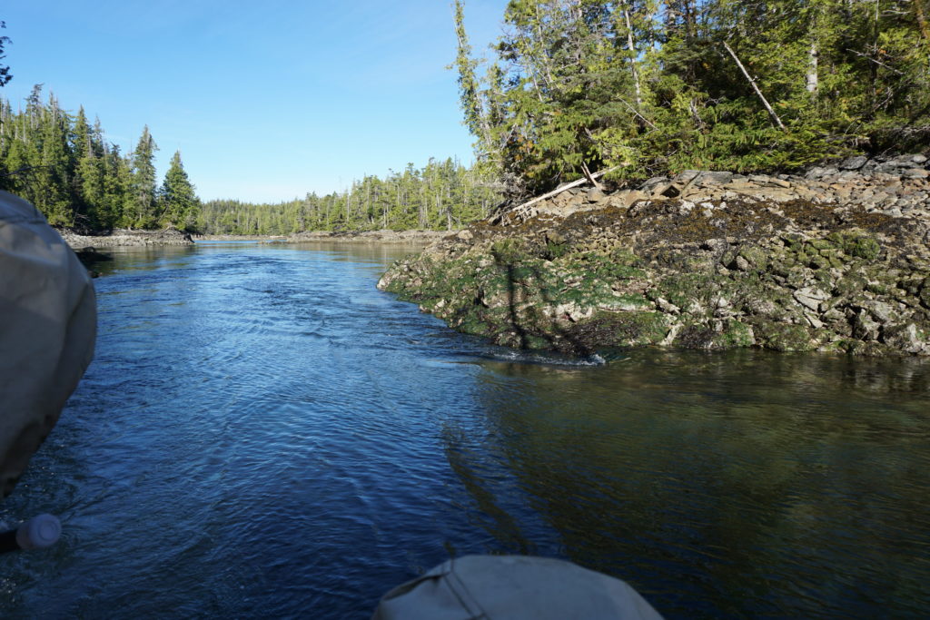
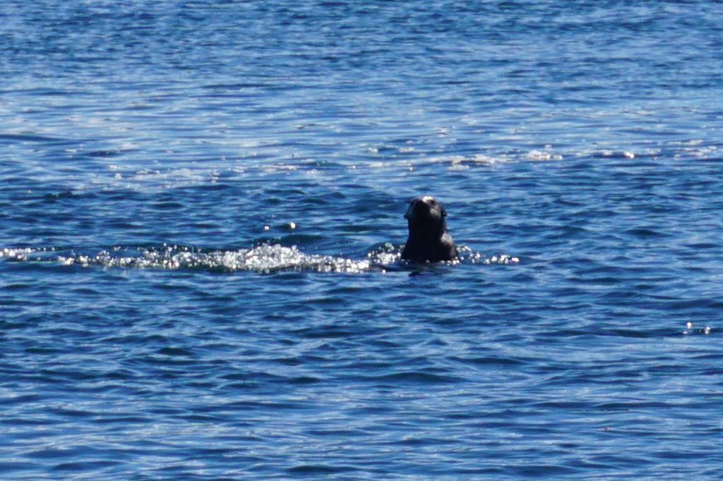
Sea Otter, Tlevak Narrows. These curious guys dive when you get within 50-100 feet and would be some of the most photogenic if I had the right lens. I don’t remember the sea otters on Vancouver Island being so shy, maybe I’ll get better pics in a couple weeks.

DSC03393
Sand Piper, Coronation Island. I think this is a sand piper, I’m not a bird expert. But I hope to develop my bird watching skills, its fun.
DSC03379 
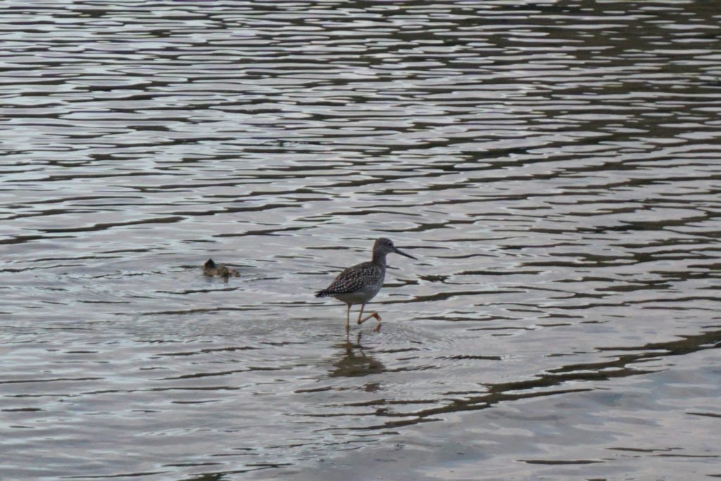
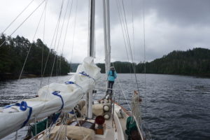
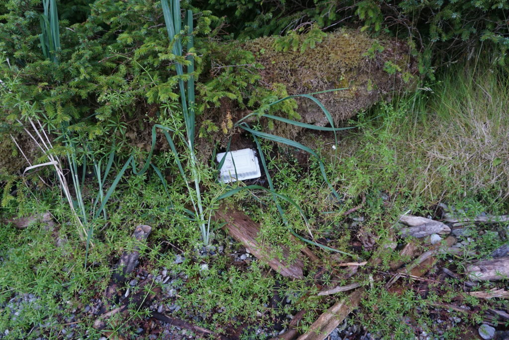
Tofu Container, Coronation Island moss forest. This elusive creature was spotted well above the high tide line, deep in the mysterious boundary between the shore and the forest. Actually, it struck me as quite ironic. As a quasi-vegan (what’s that mean? I don’t know) I eat tofu as a way to lower my impact on the environment. But here’s the plastic evidence in front of me, there are no easy answers.
DSC03309 
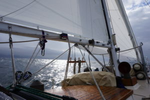
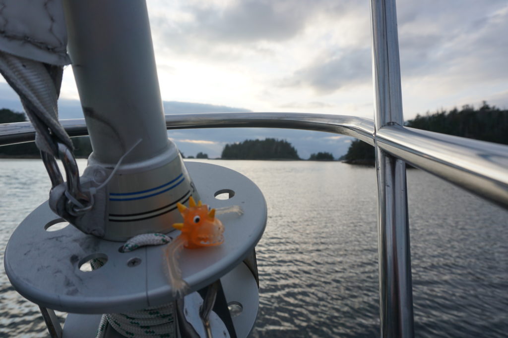
Sigmund the Jib Furler Serpent. You’ve maybe seen him before in a post, he came on board in Astoria in 2015. His jib job is to watch for dangers such as aids to navigation that may suddenly jump into your path. Like those major channel marker buoys on the Columbia River for example. Long story. Sigmund almost went overboard last year, it was a close thing. He may have been drinking at the time but he’s OK now.
DSC03296 
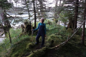
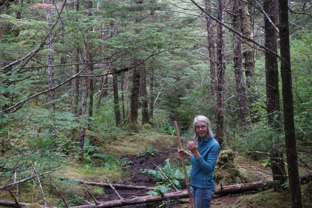
Possibly evil witch beckoning me further into the forest. She said she had a house made of ginger bread and sugar frosting. Sure she was beautiful but something in her eyes was freaky weird. I told her I had an allergy to ginger and that I thought I heard my mama calling me home. I didn’t walk the other way, I ran.

DSC03207 
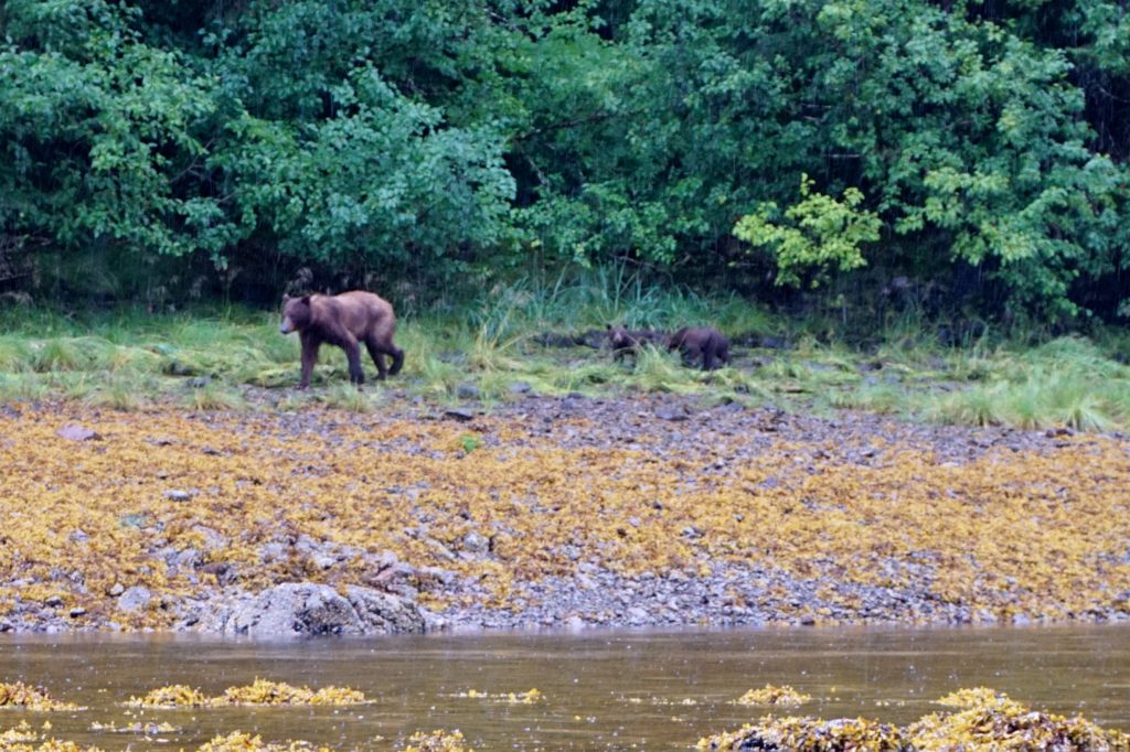
Grizzly mama and cubs, Pavlof Harbor. These guys were about 100′ away from where we were rowing our inflatable. We had seen an abandoned salmon on the rocky shore just laying there for like a half hour, but less than 1 minute before the bears got there an eagle swooped down and flew off with it. Poor bears sniffed around and around that spot. Mama’s looking a little thin I think? I dunno.

DSC03149

Salmon a-leaping. Every freaking where along the way. I’m told they’re humpies? Maybe they’re practicing spawning, don’t think they’re escaping predators. But one day we sailed with our little net hanging off the side of the boat  as we cruised along at 5 knots. In the air, above the water you understand. So we weren’t fishing, nope. But if one of them wanted to jump into our net, well, that would have been interesting.
DSC03142 - Version 2 
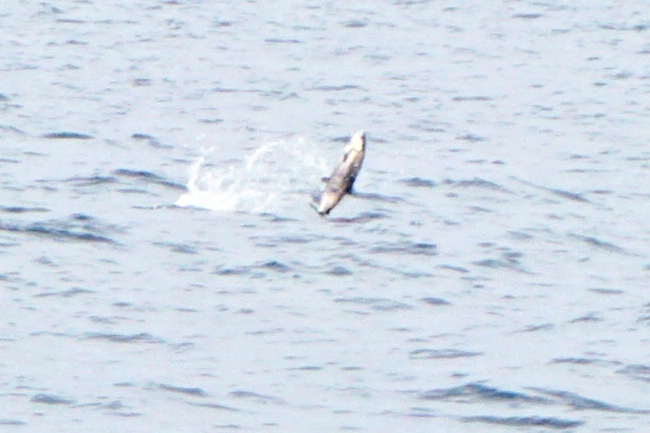
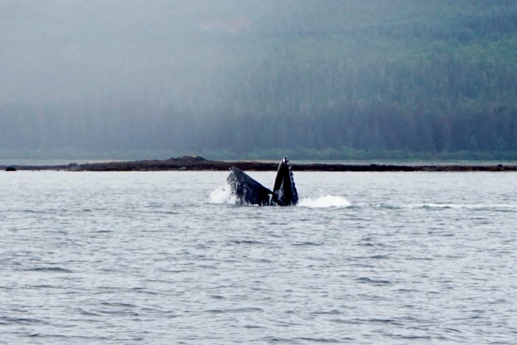
Humpback feeding in Icy Strait. Might jaws of baleen! Humpbacks will get their own blog post soon.

DSC02415 
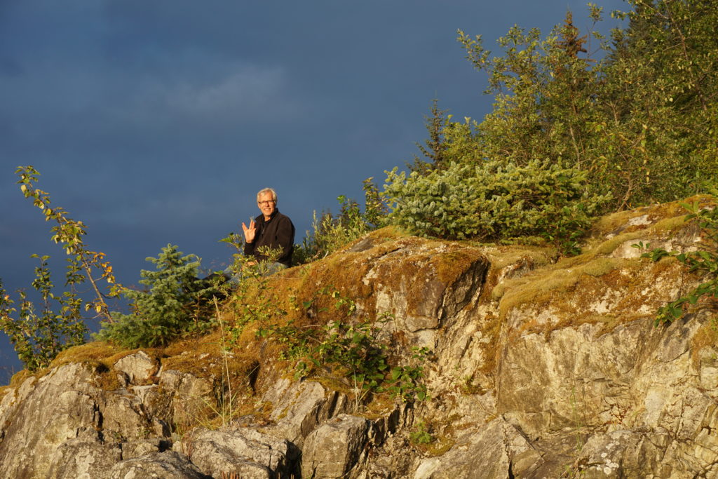
The Guru of Wachussett Inlet, Glacier Bay. He told me “live long and prosper”, so I’ve got that going for me.

DSC02942 - Version 2

Grizzly bear swimming across our intended anchorage, near Muir Inlet Glacier Bay. After he shook himself dry like a big dog he wandered upslope into the trees. This was one anchorage where we didn’t row ashore to explore the beach. That night Karen let the dinghy way out away from the boat so you know who couldn’t use it as a step to get into out boat. Smart thinking, girl!
DSC02389

The Green Goose, also seen in Wachussett Inlet. This Nordic Tug’s migratory pattern will soon soon lead it back to Anacortes, WA for winter breeding season.

DSC02913

Sol Duc and a little berg being calved from Margorie Glacier. Sol Duc’s normal lives in Sitka but poor little critter had to be pulled out of the water to get something fixed in Hoonah before flying back home.

DSC01661

Yellow-bellied berg lizard, at Baird Glacier, Thomas Bay. This critter’s saying “Thanks Southeast”, see you again soon!

DSC01500

Truly, deer friends, this is butt of all jokes is the end!


Sitka to Craig: Passage to The Nipples!

I asked Karen to show me “The Nipples”, so she did. First she had to take us down the outside and it was a bit rough. Then she brought us up the inside and it was sweet and easy. This is the story of the trip from Sitka to Craig that took about a week.DSC03309

We left Sitka not too early in the morning, had some chores to do maybe. Oh yes, now I remember. I had to walk to the library on the other side of town and scam onto their free internet so I could post that last blog. It was easy peasy since no other fools were out inter netting at that time. Then we made a quick stop at the fuel dock and then we were off, heading southwest out the wonderfully intricate passage from Sitka out to the west coast of Baranof Island. We planned a short day so we could stop at Goddard Hot Springs. On arrival we found (sounds like a Fire/EMS report) s/v Balthazar who had shared Hanus Bay with us and who we had found out were from Montreal. Their’s is one very capable offshore cruiser in a unique aqua marine color. They were in the very small cove just out from the NSFS hot springs shelters so we went into a little cove next door. We realized later at low tide how lucky we’d been going in because we just missed going aground as we blindly navigated a dog-leg into the place.

Once in however we went ashore in the dinghy and found the old cabin (now a Boy Scout cabin) and the old boardwalk (nicely renovated) that led over to the hot springs. We arrived at the upper hot springs shelter as a crew from a fishing boat were leaving below and as the Balthazar crew were coming ashore. We stripped down to our suits and tried to dip in but it was too boiling hot. It wasn’t until we figured out how to work the drain and the hot and cold taps that we were able to take our baths. Once in the water it was oh-so-wonderful! It was hot, hot, hot and made us dizzy when we stood up. We soaked for about an hour until we got hungry.

DSC03298DSC03302

On the way back along the boardwalk trail we ate wild blueberries and couldn’t stop giggling as we were singing stupid songs or jingles to let bears know we were too stupid to eat. We were still giddy when we got back to the boat. Next morning we sobered up at low low tide (“minus tide”) as we really saw the immense obstacles we had dodged on our way in. No wonder no other boats were in here with us. We made it out fine though and then headed south for more challenge.

DSC03317

Dorothy Narrows, then First Narrows, then Second Narrows. All very tight and shallow little passages. Karen did bow watch duty watching the bottom about 8 feet below as we went ahead dead slow with our 5 foot draft. As we finally went through the last challenge to deeper water the swells remind us of the ocean outside. We headed out about 3 miles offshore and then raised sails to head south to the entrance to Sandy Bay. The 6 foots swells seemed much bigger and were pushing us in but the rocks on each side seemed pretty close as the waves were breaking on them. After we made it in we found a sweet little unnamed nook near a waterfall and settled in for sunset and happy hour.

Next morning out we went, followed closely by a fishing vessel and again headed west to gain a few mile offing from the shore before we turned south along the offshore coast. The forecast was for winds of 20 knot from the northwest with 7 foot seas and that’s basically what we got. At times it was smooth going and at other times quite rough. One of became a little queasy, shall we say, after spending a little too much time below. At the bottom of Baranof is Cape Ommaney and the queasy one suggested maybe we could head around the Cape and head in to Port Alexander which seemed to be the closest landfall at the time. However when we turned in that direction we noticed the seas seemed quite confused. Weird little peaky waves were overlaid on swells from multiple directions. Very uncomfortable. When we turned back south towards our original destination the sea conditions seemed more tolerable. and the sails were pulling well. Coronation Island was only 18 miles away. The sun came out,the swells seemed to moderate and so our decision was made. Later the swells grew larger as we were basically in the body of water known as Dixon Entrance but the sails were pulling well and things seemed quite nice.

DSC03354

Coronation Island is a wonderful wilderness area. After dinner we went ashore and walked along the beach When we tried to walk into the forest we were stopped by deep deep moss and impenetrable forest. We could see and hear the whales at sunset out at the entrance to Egg Harbor and it was quite magical. One other fishing vessel came in to anchor about a half mile away from us.

DSC03399

Next day we set out past a meandering whale towards the Spanish Islands and through a narrow passage then sailed up towards Sumner Strait. What a sweet day! Sunny and just enough wind to keep us moving smartly without the engine. Past Cape Decision and up to Shakan Bay we went. When we turned to enter Shakan Bay things got a little exciting ,instead of sailing downwind we were now on a beam reach and the late afternoon wind surge was coming up. Heeled over and struggling to control a weather helm we headed in. This was when we first caught site of those fabulous twin peaks, the notorious Nipples, high above the south shore of Shakan Bay. What a sight! Hard to describe the joy that The Nipples can bring.

DSC03440  
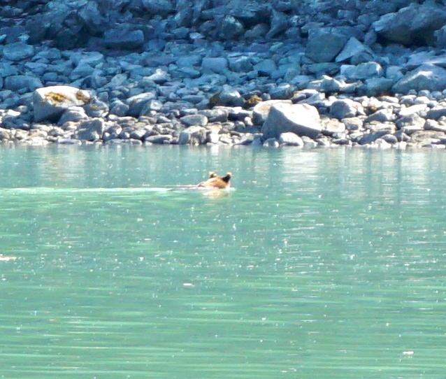
Thar be the nipples!

Soon however, we had to return our attention to dodging rocks and oohing and aahing at the many cute “little” sea otters. Twisting and dodging we finally found our way to Calder Bay at the foot of an immense 3500’ limestone peak. Somehow the wind was blowing right into this protected anchorage but our anchor bit nicely and we laid out our usual 3:1 scope and settled in for the night.

DSC03450

We left Calder Bay on a “minus” tide, 2 feet lower than low and headed for a skinny shallow stretch of water known as Dry Passage. This is part of the larger El Capitan passage. Wow, it was tight and tricky! We had to ignore the GPS mostly and just steer down the middle. At times we had about 5 feet of water under our keel and it required a lot of slow going and careful attention. It was beautiful, however, with lots of birds, river otters and deer. We only saw two kayakers and no other boats during the 2 hour trip.

DSC03521DSC03510

For a break we pulled up to the Forest Service dock at El Capitan cave and we got lucky and were able to sign up for a tour of the cave. Helmets and head lamps were provided and two geology majors working as summer interns, Alex and Carl, took us in an pointed out various features and fossils. It was a very cool experience, at one point we stopped and turned off all lights and just sat and listened to the sounds of water dripping though the limestone

.DSC03579DSC03594

We had a leisurely sail down to a tiny little nook that had no name but which was very protected and a great place to watch an amazing summer sunset. Next morning dawned fresh and clear and we made our way through a labyrinth of tiny little islands, lots of rocky reefs, a few sections of “narrows” and out onto Sea Otter Sound and across the Gulf of Escabel to Craig. A couple times we had the wind come up quickly and strongly and we were able to sail. At the end of the day we were flying downwind at hull speed (our maximum)with only our two head sails set out in a wing and wing configuration. Very exhilarating it was when we turned aside and entered into a protected anchorage through a cauldron of reefs with waves breaking over them. We were glad to have a tiny little patch of quiet and calm where we could watch kingfishers and eagles soaring above, seemingly stationary as they were gliding in place about a hundred feet up.

We’re hanging out in Craig for a couple days, doing chores and searching for that original Craig’s List that we think is around here someplace. Next challenge as we head south is rounding Cape Chacon and crossing Dixon Entrance. Hoping for some decent weather.

Sitka Surreal

One of the good things I’ve experienced cruising along the Alaskan coastal waters known as Southeast is being cut off from cell and internet service for days at a time. I used to read multiple political blogs and news sites every day but now I feel disconnected from the American political scene. On arriving in Sitka I spent some time internetting and I was struck with a sense of the surreal. Its like the Twilight Zone, I can’t believe how weird things have become. Donald Trump? Are you kidding me? Hilary Clinton is really the best we can do? WTF?

I mean, whatever happened to the little bird from Bernie Sander’s event in Portland? I really don’t know how all this came to be but I might just hang out in Canada until November if they’ll have me. Just kidding, I guess I’m coming back to vote. But holy shit, where is this crazy train going?

Meanwhile, things in Sitka seem pretty normal I guess. If you disconnect from the internet and wander around you’ll see it all. I like to walk with no particular destination in mind and thus we found ourselves at the edge of a typical neighborhood at a trail with a sign warning that we were entering onto sacred grounds and to act accordingly. (Always good advice.) It was a predominantly Russian Orthodox cemetery buried in the woods and being tended carefully by nature. Graves were tilted every which way upon the misty wooded slopes as though they’d been washed up by the sea.

DSC03280DSC03282

Five minutes later we popped out onto Saw Creek Road and walked through a national military cemetery. How different the two were from one another. Not sure what that means.

DSC03285

We wandered on and found this Sitka Surreal phone booth. It makes about as much sense as Donald Trump running for president.

DSC03286

One is forced to ponder the question, “Yes, but is it art?”

Stopped to browse the Etolin St. Library.  Then past the grocery. Stopped for a bite to eat at the Larkspur, the cafe with a radio station upstairs.

DSC03287

DSC03288

DSC03257

Headed back through town to the harbor, paying attention to Community bulletin boards and was reminded of issues more important than our Clinton Trump tragicomedy.

DSC03275 DSC03276 DSC03279

So, my advice is when in Sitka, relax and keep it local. Put on your xtratuf sneakers, wander around a little, listen to the Raven, and try the local brew.

DSC03255 DSC03292

Thanks for the reality check, Sitka! Sea ya later.

Glacier Bay video

Greetings! Karen and I arrived in Sitka and are taking advantage of the free internet at the excellent library here to try to learn how to post videos to Youtube and include them on the blog here. So….. without further ado, here’s our first effort. Hope it works for you, it seemed to load a little slow for me.